01 November 2026, 06:49
The Amazing South: Kazantip—the Stone Ring of the Sea of Azov
Ця стаття також доступна українською

Cape Kazantip. PHOTO: ua.igotoworld.com
Cape Kazantip is a unique natural landmark on the northern coast of the Kerch Peninsula in Crimea that juts out deeply into the waters of the Sea of Azov for a distance of about two kilometers. One of the most striking and unusual geographical features of the peninsula’s northern coast will be the focus of the next installment in our regular series, “The Amazing South.”
Cape Kazantip separates two bays of the Sea of Azov—the Arabat Bay to the west and the Kazantip Bay to the east. The peninsula’s coastline is highly indented: small coves alternate with rocky capes, cliffs, and beaches. Its total length, according to rough estimates, exceeds 10 km.
The Kazantip Peninsula consists of a large oval coastal section and a narrow, low-lying isthmus about 1.5 km wide, which connects it to the Kerch Peninsula. The village of Mysove is located at the base of the cape, on the isthmus. Beyond it lies the rocky part of Kazantip, featuring a ring-shaped ridge and a large basin in the center.
Origin of the Name
The place name “Kazantip” has Crimean Tatar roots (in Crimean Tatar Cyrillic: къазан тип). Translated from Crimean Tatar, the name means “bottom of a cauldron” (“къазан” means “cauldron,” and “тип” means “bottom”). This name reflects the distinctive features of the local terrain: a ring-shaped limestone ridge and a large depression in the central part of the peninsula, which give Kazantip the appearance of a cauldron or bowl.
A Peninsula on a Peninsula
From a geological perspective, Kazantip is a fossilized moss reef. According to one modern scientific hypothesis, it formed not on a flat seabed but on the slopes of an underwater uplift associated with the activity of an ancient mud volcano. Small colonial marine animals—bryozoans—settled on its slopes; their colonies resemble corals in appearance. Over a long period of time, their calcareous skeletons accumulated, forming reef structures that today make up the characteristic ring-shaped ridge of Kazantip.
Over time, the less stable clayey rocks in the central part of the cape were gradually eroded and weathered away, while the durable limestones of the ancient reef remained intact, forming a high ring-shaped ridge.
For some time, Kazantip was an island. Later, as a result of the transport and accumulation of sand and shell material driven by ocean waves and currents, an accumulative barrier—a tombolo—formed. It connected the former reef island to the Kerch Peninsula, transforming it into a peninsula.
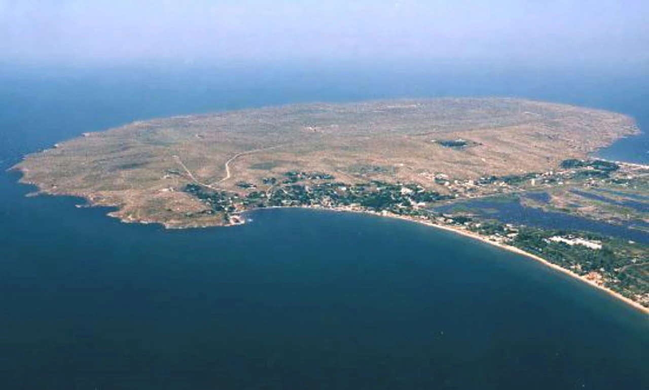
Kazantip Peninsula. PHOTO: chernoe-more.in.ua
The relief of the cape
Kazantip has a distinctive ring-shaped structure that resembles the shape of oceanic atolls. Its topography can be roughly divided into three parts.
The outer ring-shaped ridge is composed of mossy limestone; its outer slopes, facing the sea, are steep and precipitous in places. The highest point of the cape reaches about 107 m above sea level. The ridge’s elevations generally range from 30 to 40 m.
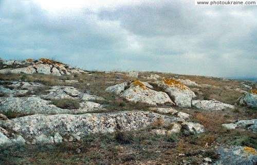
Outer ring-shaped ridge. PHOTO: pryroda.in.ua
The central basin is the lower, inner part of the cape, located at an elevation of about 20–30 m above sea level. This is a predominantly flat area of feather grass steppe, where ancient clayey rocks outcrop. The Aktas (Mysove) oil field is located within the Kazantip area; it was once developed using oil wells.
Coastal strip. The cape’s coastline is characterized by an alternation of steep rocky cliffs, small bays, and beaches. This zone is characterized by landslides, chaotic accumulations of boulders, abrasion niches, sea-eroded rock overhangs, and weathering features.
Bays and Capes
Kazantip’s coastline is indented by rocky limestone capes that separate numerous small bays. Here are some of them.
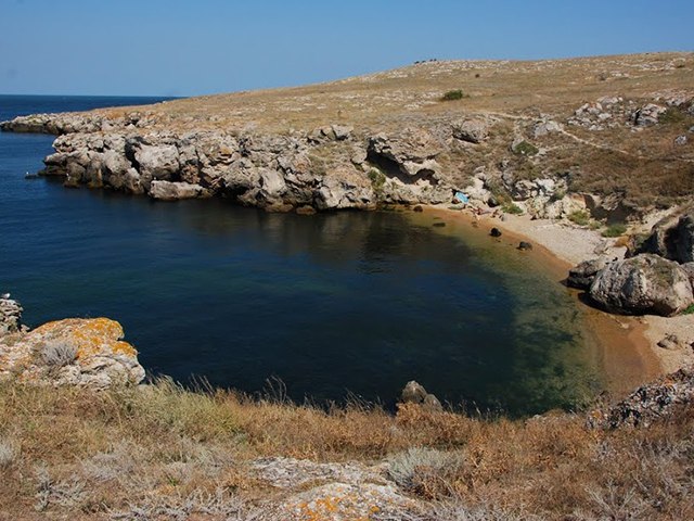
A bay on Kazantip. PHOTO: o-go-go.com
Tatar Bay
Located on the eastern side of the Kazantip Isthmus, in the western part of Kazantip Bay. A wide sandy-shell beach stretches along the bay, a significant portion of which remains undeveloped.
Ruska Bay
It stretches along the western side of the Kazantip Isthmus and directly adjoins the town of Shcholkino and the western part of the village of Mysovo. It opens into the Arabat Gulf. The coastline here curves gently, and the beach is mostly covered with fine sand and crushed shell rock.
Sharabay Bay
It is distinguished by rocky formations that have taken on whimsical shapes under the influence of wind and water. Some of them resemble animals or mythical creatures.
Kazantip Nature Reserve
The Kazantip Nature Reserve was established on May 12, 1998, to preserve the unique steppe landscapes, the moss reef, and biological diversity. The reserve’s total area is 450.1 hectares, of which 394.1 hectares are land, and 56 hectares are the coastal waters of the Sea of Azov, forming a 50-meter-wide strip around the cape.
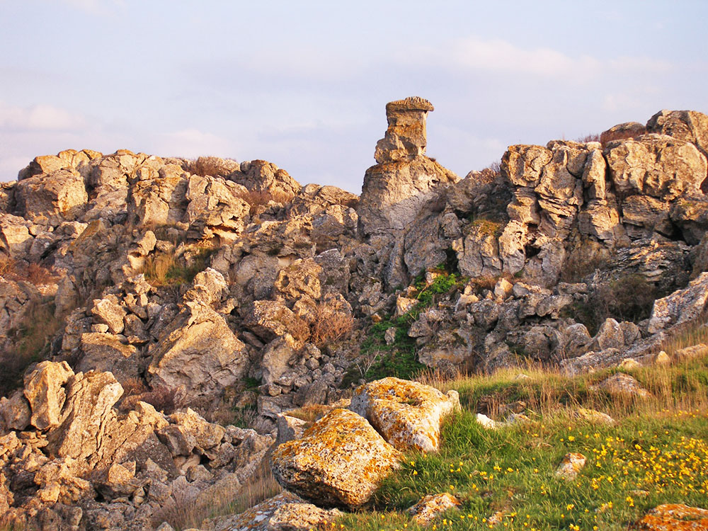
Kazantip Nature Reserve. PHOTO: yavorpark.in.ua
The reserve operates under a strict nature conservation regime that restricts economic activity, motor vehicle traffic, and construction. The 251-hectare aquatic-rock complex of Cape Kazantip is also included in the Ramsar List of Wetlands of International Importance.
Floristic Diversity
Prior to the annexation of Crimea, 627 species of vascular plants were recorded within the reserve. Some of them are listed in the Red Book of Ukraine.
The vegetation of the cape consists mainly of feather grass and rocky steppes, as well as shrub thickets. Sandy and halophytic vegetation is widespread in coastal areas.
Among the characteristic representatives of Kazantip’s flora are:
Feather grass—several Red Book species have been identified on Kazantip: Lessing’s feather grass, hairy feather grass, Browner’s feather grass, and tufted feather grass.
Pallas’s crocus, Schrenk’s tulip, snake-leaved tulip, yellow asphodeline, and many other plant species also grow here.
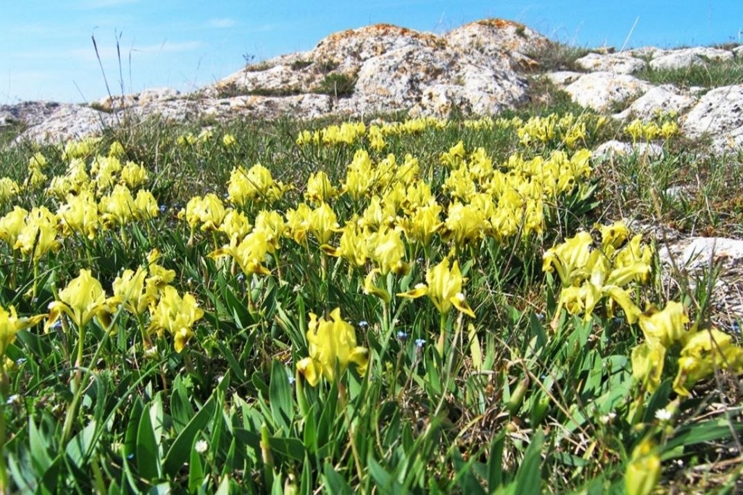
Low irises on Kazantip. PHOTO: esu.com.ua
Fauna of the Reserve
According to pre-war data, the fauna of the Kazantip Nature Reserve included about 200 species of vertebrates and over 450 species of invertebrates. More than 30 animal species listed in Ukraine’s Red Book have been recorded within the reserve.
Among reptiles, the yellow-bellied snake, steppe viper, yellow-bellied snake, and water snake are of particular value. Rare insects found among the invertebrates include the steppe grasshopper, the striped empusa, the swallowtail butterfly, the podalirius, and the carpenter bee.
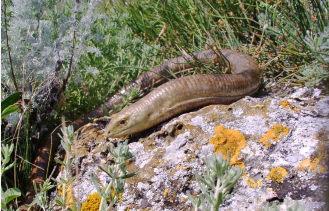
Yellow-bellied snake. PHOTO: esu.com.ua
Among the reserve’s mammals are the steppe polecat and the greater horseshoe bat, one of several bat species. Due to the occupation of Crimea, opportunities for independent research into the current state of the reserve’s fauna are significantly limited.
The cape is an important stopover point on bird migration routes. Among the species recorded here before the war are the red-footed falcon, the steppe kestrel, and the steppe crane. The coastal areas are also important for waterfowl and shorebirds, particularly herons. Rocky cliffs and caves provide suitable nesting conditions for certain bird species.
Archaeological Heritage and Ancient Monuments
Kazantip has a long history of human settlement. Monuments from various historical eras—ranging from antiquity to the Middle Ages—have been documented on its territory.
On the southeastern coast of Cape Kazantip, the remains of ancient settlements have been discovered; one of them, according to one theory, is associated with the city of Heraclius, mentioned in the works of Claudius Ptolemy.
Archaeological excavations have uncovered the remains of stone defensive walls and residential and economic structures. The settlement was also protected by a defensive moat and an earthen rampart. In addition, archaeologists have documented an underground passage leading to the seashore.
On the cape’s coastline, the remains of an ancient Roman-era estate, stone structures, and artificial terraces have also been preserved.
The Kazantip Lighthouse
Cape Kazantip has long posed a danger to navigation due to coastal rocks and shoals. To help ships navigate, a lighthouse was erected at the tip of the cape, which rises approximately 107 meters above sea level. Its location allowed sailors to orient themselves while passing near Kazantip.
The Kazantip Lighthouse has its own history. According to a 1933 navigational description, it was a gray stone tower with a lantern mounted on a metal support. The lighthouse emitted a white flashing light, which served as a landmark for ships in this part of the Sea of Azov.
Over time, the navigational equipment on the cape changed. In a 2003 British navigational guide, the Kazantip light is described as a beacon on a small triangular tower four meters high with a black rectangular shield. Thus, a more compact navigational structure was used in place of the historic stone lighthouse.
Despite the relatively small size of the later structure, the Kazantip navigation light remained an important landmark for ships in the Sea of Azov. Navigational documents also note underwater rocks and shoals near the cape, which required sailors to exercise particular caution. Information regarding the current condition and operation of the navigational equipment following the occupation of Crimea requires independent verification.
The “Kazantip” Festival
Cape Kazantip gained widespread international recognition thanks to the eponymous “Kazantip” electronic music and sports festival.
The festival began in the early 1990s as a windsurfing competition. Its founder was Mykyta Marshunok, who was an avid windsurfer. In search of favorable conditions for this sport, he discovered Cape Kazantip back in the 1980s and began visiting it regularly with friends.
In 1993, the first windsurfing championship, organized by Marshunok, took place in the Cape area. Competitors spent their days on the water and gathered on the seashore in the evenings to listen to music and throw informal parties. It was these gatherings that gradually laid the foundation for the future music festival.
The competition became an annual event, and the musical component of the festival grew in importance. By 1994, the parties already featured performances by musicians and the use of stage equipment. Eventually, DJs began joining the festival, and electronic music gradually displaced the sports competitions from the center of the participants’ attention.
A turning point came in 1995. Marshunok and his team decided to use the premises of the unfinished Crimean Nuclear Power Plant near Shcholkino to host a large-scale party. The abandoned power unit, with its massive concrete structures, became an unusual venue for a rave. The “Reactor” party was organized there, marking the beginning of one of the most famous chapters in the festival’s history.
In the second half of the 1990s, the music component increasingly overshadowed the sports aspect. The festival gradually transformed into a large-scale electronic music event and later adopted the concept of a fictional state—the “Republic of Kazantip.” It developed its own symbols, rules, “visas” for visitors, and even a “president.” One of the most famous symbols was a yellow suitcase, which, upon meeting the organizers’ requirements, granted free admission to the festival.
The festival was held in the Kazantip area through 1999. In 2000, it moved to the village of Veseloye near Sudak, and from 2001 to 2013, it was held in the village of Popivka on the western coast of Crimea. Thus, the festival lost its direct geographical connection to Cape Kazantip but retained its name, which has become a well-known international brand.
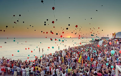
The “Republic of Kazantip” Festival. PHOTO: kor.ill.in.ua
The Consequences of the Russian Occupation for Cape Kazantip
Russia’s occupation of Crimea in 2014 and the subsequent militarization of the region posed serious threats to Kazantip’s natural ecosystems. Ukraine lost the ability to directly control the reserve’s territory and ensure compliance with its nature conservation regime.
In 2020, the occupying authorities dissolved the Kazantip Nature Reserve as a separate institution, transferring its management to “Zapovidny Krym,” an organization controlled by Russia. At the same time, the protected area itself formally retained its nature conservation status.
Following the start of the full-scale Russian invasion in 2022, military activity in Crimea has heightened threats to the environment. In particular, in June 2024, there were reports of Russian radar stations being struck in the area of the village of Mysove, near Kazantyp. Military activity—including noise, explosions, and potential contamination of the area—poses a potential threat to steppe ecosystems and animal habitats.
The occupation has also limited the ability of Ukrainian scientists and conservation organizations to study Kazantip. Although isolated scientific observations continued to be conducted within the reserve under the supervision of the occupying administration, independent monitoring of its natural ecosystems remains impossible.
Юлія Сичова