06 September 2026, 06:53
The Wondrous South: The Kerch Strait—From Ancient Bosporus to the Present Day
Ця стаття також доступна українською

Kerch Strait. PHOTO: foto.papik.pro
The Kerch Strait is a narrow stretch of water that separates the Kerch Peninsula in the Ukrainian Crimea—which is temporarily occupied by Russia—from Russia’s Taman Peninsula and connects the Black Sea and the Sea of Azov. With this story about this unique natural feature, Intent continues its ongoing series “The Amazing South.”
Geographical Characteristics
The strait is about 41 km long. Its width varies depending on the section: in the northern part, it is approximately 4–5 km wide; in the central part, it narrows to about 3 km; and in the southern part, it widens. Depths also vary: the central part is shallow, mostly 3–5 m, while depths increase in the northern and southern sections. In some areas, maximum depths reach about 18 m.
The western coast of the strait is formed by the Kerch Peninsula, and the eastern coast by the Taman Peninsula. The Kerch Bay, with a depth of approximately 5 m, is also located in the western part.
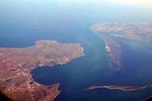
Kerch Strait. PHOTO: i.lb.ua
A distinctive feature of the Kerch Strait is its geological and landscape diversity. The nature of the coastline here varies: rocky and steep sections alternate with low, sandy shores. It is precisely these contrasts that create the strait’s distinctive landscape.
The Formation of the Kerch Strait
The Kerch Strait did not form as a result of a single event. Its current appearance was shaped over a long period of time by tectonic processes, climate change, and fluctuations in sea level. Throughout various geological eras, the contours of the land and the waterways in this region have changed repeatedly.
- Tectonic processes. The topography of the Kerch and Taman peninsulas was shaped by movements of the Earth’s crust. These movements, in particular, determined the structure of the lowland area between Crimea and the Caucasus, where the strait eventually formed.
- Water Level Fluctuations. During glacial periods, a significant portion of the water was locked up in glaciers, so the global sea level was considerably lower than it is today. As the climate warmed and the glaciers melted, sea levels rose, altering the Black Sea and Azov Sea basins as well.
- Flooding of low-lying areas. After the end of the last ice age, sea levels began to rise. Water gradually flooded the low-lying areas of land between Crimea and the Caucasus, and over time, a strait formed here, connecting the Black Sea and the Sea of Azov.
Water Exchange Between the Azov and Black Seas
The Kerch Strait is a dynamic environment where water is constantly in motion. The nature of water exchange is influenced by wind, differences in salinity and water levels, as well as outflow from the Azov Sea basin. According to the Encyclopedia of Modern Ukraine, the relatively fresher and lighter Azov waters predominantly move in the upper layer toward the Black Sea, while the saltier and denser Black Sea waters can flow into the strait in the opposite direction—primarily in the bottom layer.
Natural Features of the Strait’s Coastline
- Cape Fonar is the easternmost point of the Crimean Peninsula, located where the Kerch Strait meets the Sea of Azov.
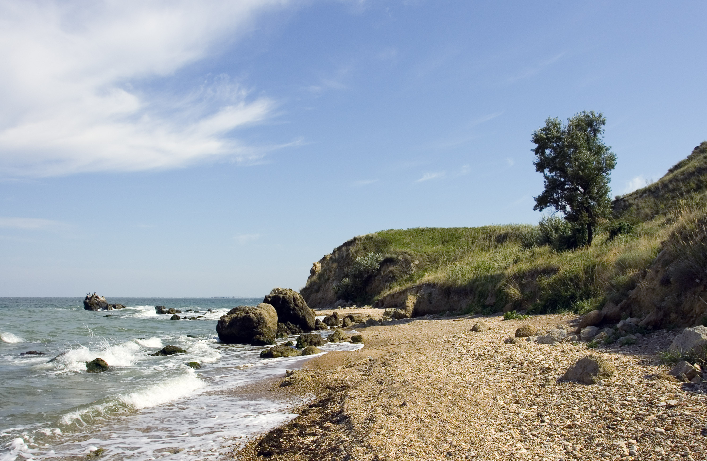
Cape Fonar. PHOTO: upload.wikimedia.org
- Cape Ak-Burun—a strategic cape that bounds Kerch Bay from the south.
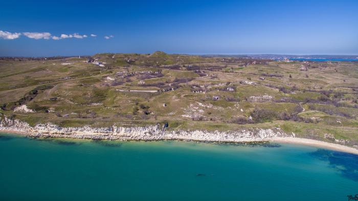
Cape Ak-Burun. PHOTO: photos.wikimapia.org
- Cape Karantynnyi and Cape Zmiinyi are natural landmarks within the city of Kerch that form the coastline of Kerch Bay.
- Lake Tobechitske is a large estuarine body of water south of Kerch with therapeutic mud.
- Lake Churbaske is a brackish lake located on the outskirts of Kerch.
- Tuzla Island and Spit is a long strip of land in the middle of the strait. In the past, it was connected to the Taman Peninsula by a natural land bridge, but in 1925, a storm eroded it, turning it into a separate island. In 2003, Tuzla became the cause of a serious political conflict with Russia. Russia attempted to build a dam to the island from its side. Currently, Russia has illegally installed supports for its bridge across this Ukrainian island.
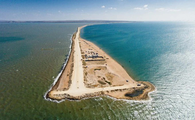
Tuzla Island. PHOTO: uimg.pravda.com.ua
Opuk Nature Reserve
One of Crimea’s most striking nature reserves stretches across Cape Opuk; it was established in 1998 to preserve unique steppe, marine, and rocky landscapes. The reserve is located in the southeastern part of the Kerch Peninsula and encompasses the area around the cape, Lake Koyas, and the adjacent waters of the Black Sea.
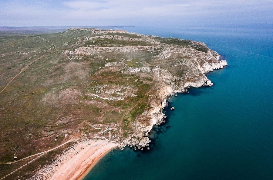
Opuk Nature Reserve. PHOTO: esu.com.ua
Major Natural and Historical Sites of the Opuk Nature Reserve
- Cape Opuk is a geographical promontory at the southern tip of the Kerch Peninsula. Rising from it is a limestone massif—Mount Opuk, 185 meters high, which drops sharply into the sea. The local cliffs feature numerous grottoes and caves.
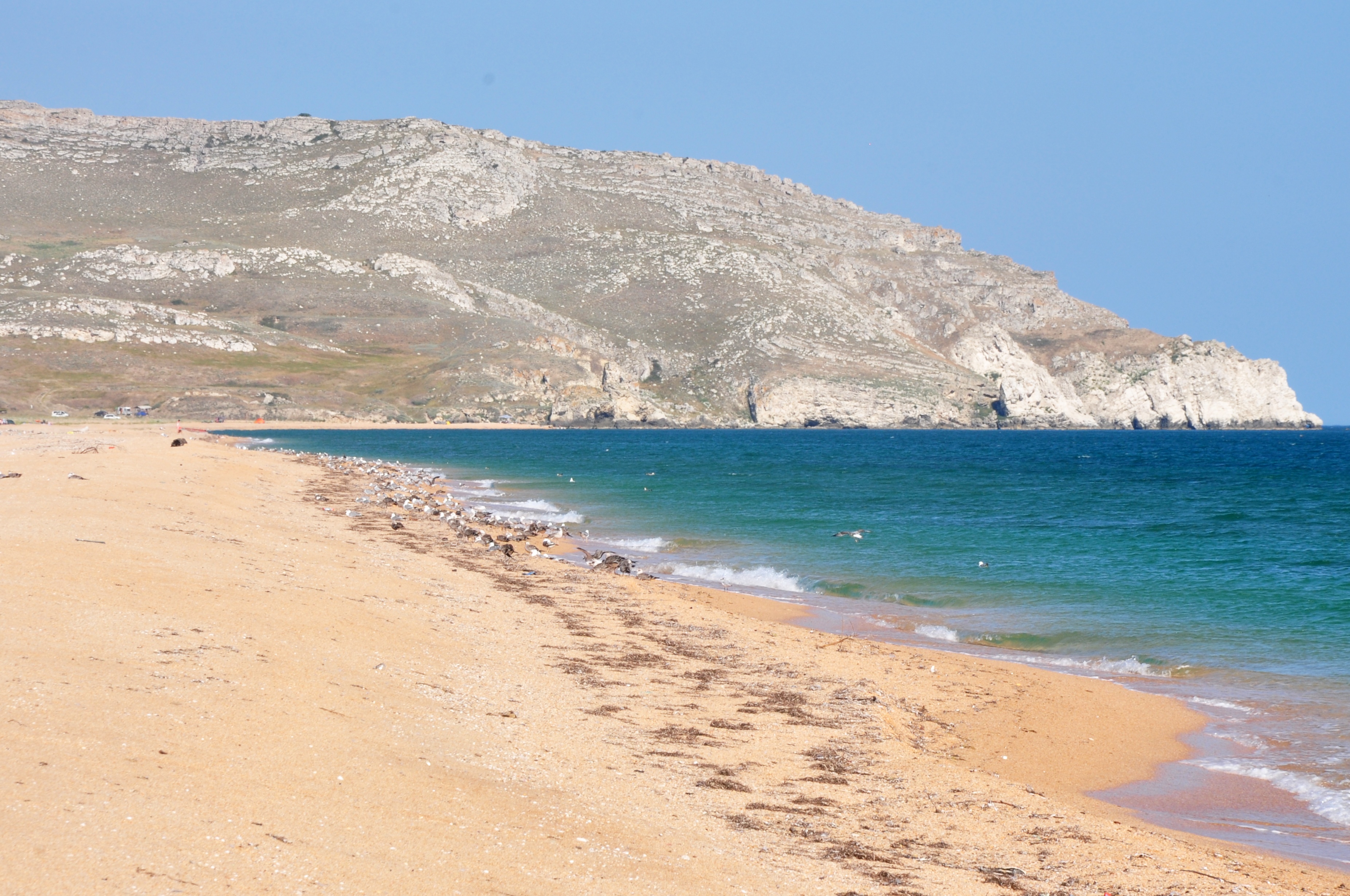
Cape Opuk and Mount Opuk. PHOTO: upload.wikimedia.org
- Lake Koyaske (Pink Lake) is the gem of the nature reserve. Its water has a pink or even deep red color due to the microalgae Dunaliella salina. The lake is separated from the Black Sea only by a narrow sandbar.
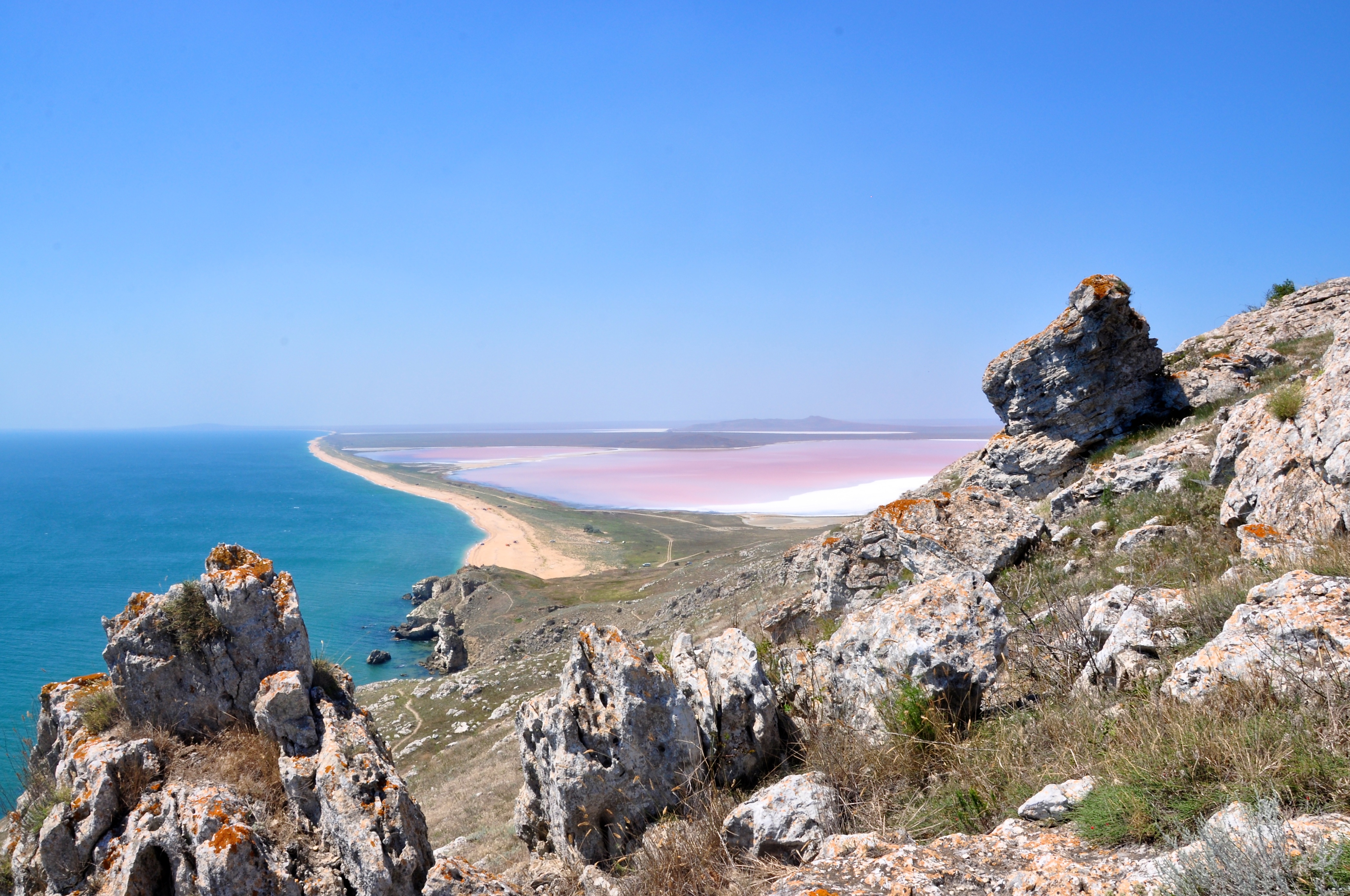
Lake Koyaske. PHOTO: upload.wikimedia.org
- Four kilometers offshore, the Ship Rocks (Elken-Kaya) rise from the sea, their outlines resembling sailing ships. Many legends are associated with them, and the cliffs themselves serve as a nesting site for seabirds, particularly cormorants.
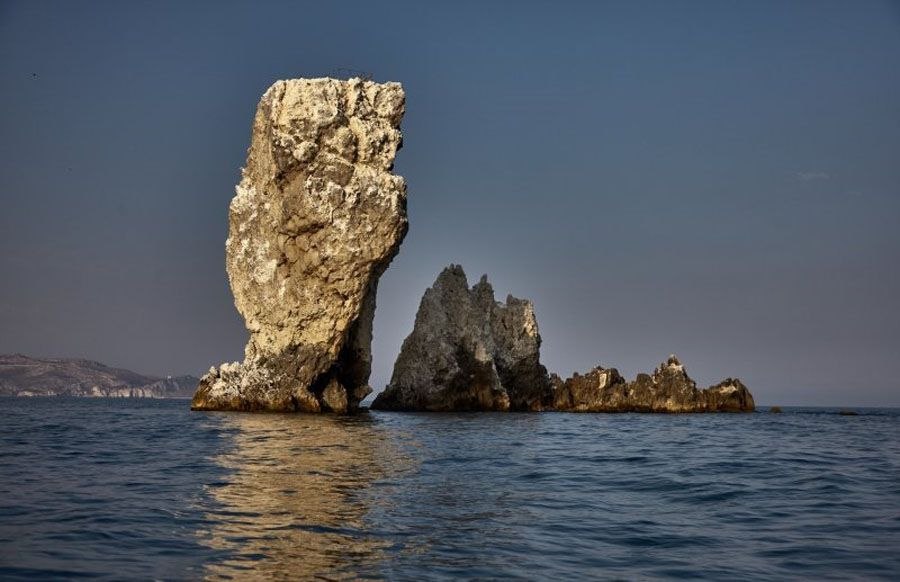
Ship Rocks. PHOTO: esu.com.ua
- Every spring (usually in April), the Opuk Steppe completely transforms. Here, wild Schrenk’s tulips, listed in the Red Book, bloom en masse. The steppe transforms into a multicolored carpet of red, yellow, and white flowers.
- Within the protected area lie the archaeological excavations of the ancient Greek city of Kimerik, which was part of the Bosporan Kingdom and served as a defensive outpost against nomadic tribes.
Since the Crimea has been temporarily occupied by Russia since 2014, the occupying authorities have militarized this region. Cape Opuk and the surrounding areas are regularly used as a military training ground for exercises and missile launches, causing immense damage to the reserve’s unique ecology and fauna.
Yenikal Lighthouse
The Yenikal Lighthouse is one of Ukraine’s most famous and important navigational landmarks, located on Cape Fonar. It is the easternmost point of the Crimean Peninsula, guiding ships as they enter the Kerch Strait from the Azov Sea. The lighthouse has a unique and very long history…
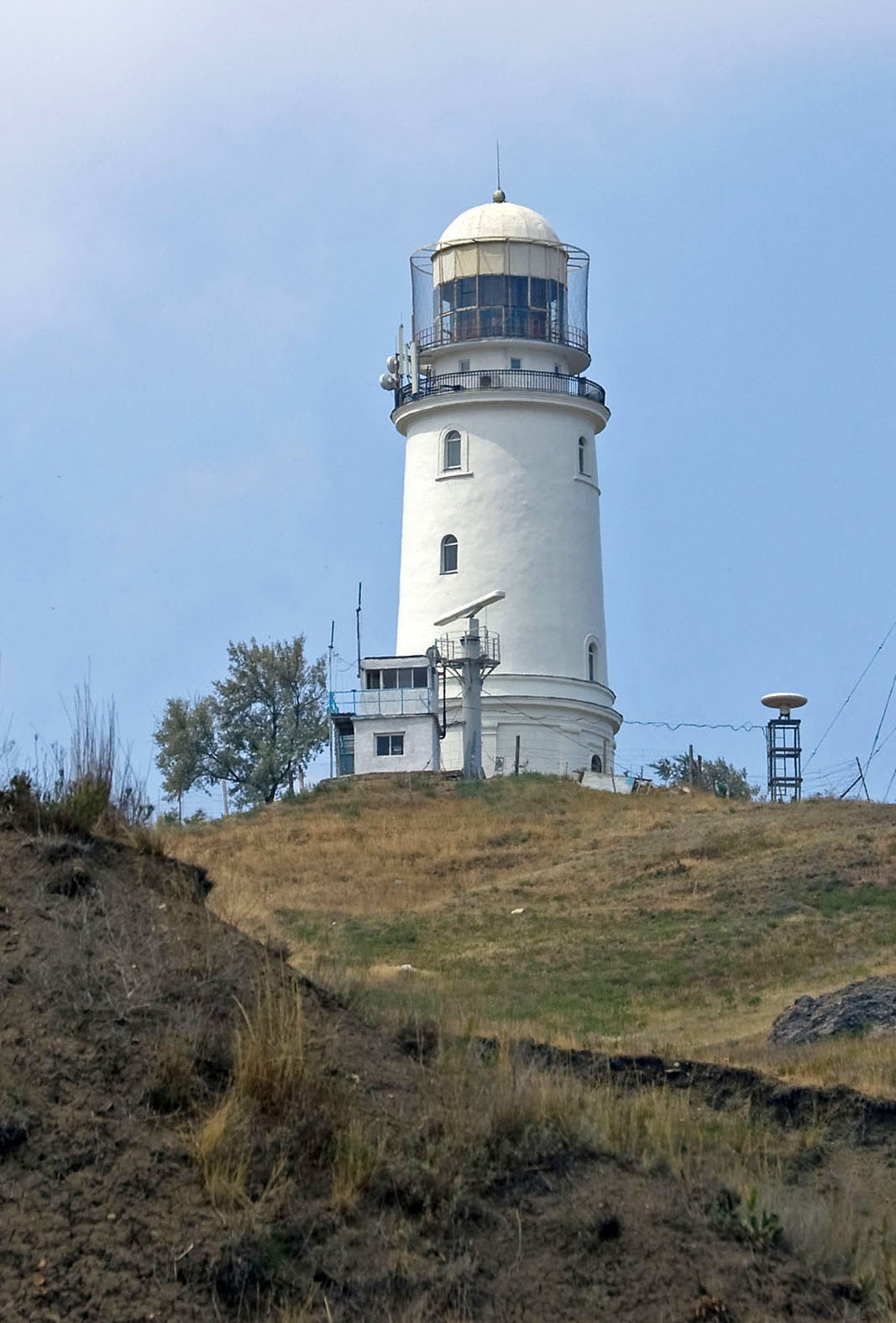
Yenikal Lighthouse. PHOTO: upload.wikimedia.org
The Lights of Parfenium
Although the official lighthouse building was erected in the 19th century, a signal fire had been burning at this site for thousands of years. The first written references to it date back to approximately 350 B.C. At that time, ancient Greek colonists built the Parfenium fortification on Cape Fonar. Every evening, large bonfires were lit on its towers, helping ancient ships safely navigate the strait.
The First Stone Tower
A permanent stone lighthouse was built here in 1820. It was named after the Ottoman fortress of Yeni-Kale, located about 5 kilometers to the south. Initially, wick lamps filled with oil were used to light the lighthouse. Over time, their number was increased to twelve. A retired officer was usually appointed as the lighthouse keeper, while local residents served as attendants.
In the late 1850s and early 1860s, a Fresnel lens—unique for its time—was ordered from abroad. The lighthouse was converted to gas lighting, which made its beam incredibly powerful. Until the start of World War II, it was considered the oldest operating lighthouse in Crimea.
During the German offensive in May 1942, the Yenikal Lighthouse found itself at the epicenter of the fighting. When German tanks broke through to it, Soviet defenders called in artillery fire on their own position. The shelling destroyed both the lighthouse and the German vehicles. Soviet soldiers and hydrographers who were ensuring safe passage across the Kerch Strait were also killed.
The Modern Tower
The snow-white, minaret-like lighthouse that can be seen in photographs today was built in 1953. It is a cylindrical stone tower equipped with a modern technical complex and a powerful optical lighting system. The cape itself offers a breathtaking view: on a clear day, you can clearly make out the shores of the Taman Peninsula and the movement of ships through the strait.
The Kerch Strait in History
In ancient Greek sources, the strait was known as the Cimmerian Bosporus. This name reflects both the natural and historical features of the region. The ancient Greek word *bosporos* is traditionally translated as “cow ford,” while the word “Cimmerian” refers to the Iranian-speaking nomadic tribes of the Cimmerians, who inhabited these territories before the start of the Great Greek Colonization. Homer himself wrote about them in the *Odyssey*, describing their lands as a realm of eternal fog and darkness at the entrance to Hades’ underworld.
According to legend, when the strait was still very shallow, the Cimmerians drove their herds of cattle directly across the water or over the ice from Crimea to Taman and back. As early as the 7th–6th centuries B.C., the strait’s coastline became a site of active Greek settlement, primarily by immigrants from Miletus.
By connecting the waters of the Black Sea and the Sea of Azov, the Cimmerian Bosporus served as a natural transport corridor, facilitating communication between the ancient Mediterranean states, the steppe regions of Eastern Europe, and the Caucasus. It was precisely the strait’s advantageous geographical location that was the decisive factor in the emergence of the Bosporan Kingdom and its long-term existence as one of the most stable political entities of the ancient world.
An important political and economic center of the region was Panticapaeum—an ancient city located on the territory of modern-day Kerch, which became the capital of the Bosporan Kingdom. Control over the strait was crucial for maritime communications, fishing, and trade between the settlements of the Kerch and Taman peninsulas and the coast of the Sea of Azov.
The Bosporan Kingdom—the First Great Power of the Northern Black Sea Region
The Bosporan Kingdom was one of the most influential ancient states that existed on the territory of modern-day Ukraine and the surrounding lands. It emerged around the 5th century BCE as a result of the unification of several Greek colonies located on the shores of the Kerch Strait. The state occupied a strategically important position between the Black and Azov Seas, which contributed to its economic and political development. Goods from various parts of the ancient world passed through the Bosporan ports, making the state an important trading center.
The kingdom’s population was multinational. It was home to Greeks, Scythians, Meotians, Sindians, Sarmatians, and representatives of other peoples. The interaction of different cultures fostered the development of art, architecture, religion, and crafts. In the cities, temples, theaters, and fortifications were built; coins were minted; and highly artistic jewelry and ceramics were created.
The political system of the Bosporan Kingdom differed from that of most Greek city-states. While republican forms of government prevailed in many cities of Hellas, Bosporus became a monarchy.
The decline of the Bosporan Kingdom accelerated in the 3rd century CE, when its economic and political power was undermined by internal difficulties and invasions by the Goths and other tribes. In the 370s, the region suffered an invasion by the Huns, after which the Bosporan Kingdom lost its former political significance. Traditionally, these events are associated with the end of its history as an ancient state.
The Two Lives of the Kerch Bridge
The idea of building a bridge across the Kerch Strait has been proposed many times. The current bridge is, in fact, the second major attempt to connect the two shores. The first bridge built collapsed almost immediately after construction was completed.
The First Kerch Bridge
During World War II, Adolf Hitler planned to build a gigantic bridge from Munich to India via the Crimea. The Nazis managed to begin construction of the bridge but completed only a military cableway and delivered a large amount of building materials. When Soviet troops drove out the Germans in 1944, Joseph Stalin ordered the urgent construction of a railway bridge using the very same captured German structural components and cement.
The 4.5-kilometer-long bridge was built in a record 6.5 months under incredibly difficult conditions. It was opened in November 1944. Due to the frantic rush, the builders did not have time to complete the protective structures (icebreakers). In the winter of 1945, thick ice drifted in from the Sea of Azov, ramming into and destroying the bridge.
The first bridge stood for just over three months, after which its remains were dismantled. The Soviet Union decided not to rebuild it.
The Modern Kerch Bridge
After the collapse of the Soviet Union, the Kerch Strait found itself between the territories of two independent states—Ukraine and Russia—and the main transportation link between Crimea and the Taman Peninsula was provided by a ferry crossing. In 2014, Russia occupied and illegally annexed Crimea and faced the problem of connecting it to its own territory, as there was no land corridor through the occupied territories of southern Ukraine at that time.
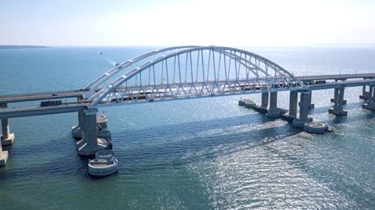
The Kerch Bridge. PHOTO: armyinform.com.ua
The illegal construction of a new 19-kilometer bridge across Tuzla Island began. The road section opened in 2018, and the rail section opened later. The bridge was built as a strategic artery for the supply of military equipment. During Russia’s full-scale invasion, the bridge became a legitimate military target for Ukraine. The Security Service of Ukraine and the Armed Forces have already successfully attacked it twice (in October 2022 using a truck loaded with explosives and in July 2023 using Sea Baby marine drones), significantly damaging the spans and supports.
Interesting Facts
- The Kerch Strait is one of the shallowest navigable straits in the world: its maximum depth is about 18 meters. Dredging operations are carried out here to maintain the necessary depths in the navigable channel.
- A visual boundary can be seen on the surface of the strait: the less salty and lighter waters of the Sea of Azov meet the darker and saltier Black Sea currents. This appears as distinct contrasting bands on the water’s surface.
- Ancient peoples considered the Bosporus Cimmerian (the Kerch Strait) a sacred boundary separating two worlds—the Europe they knew and the distant, mysterious Asia.
- The Cimmerians were nomads and outstanding horsemen. When sedentary peoples first saw Cimmerian warriors shooting arrows from their bows while galloping at full speed, they—according to legend—did not realize that a man and a horse were two different creatures. It is believed that encounters with the Cimmerians gave rise to the myth of the centaurs—half-human, half-horse creatures—in ancient Greek mythology.
- A well-known but controversial hypothesis regarding the so-called Black Sea Flood is linked to the history of the Black Sea. According to this hypothesis, after the end of the Ice Age, waters from the Mediterranean Sea began flowing into the Black Sea basin through the Bosporus, causing the sea level to rise and flooding part of the coastal lowlands. Some researchers have suggested that the memory of such large-scale flooding may have later been reflected in ancient legends about the Great Flood; however, this theory lacks unequivocal scientific confirmation.
- On Mount Opuk lies the Opukska-Yuvileina karst cavity, 33 meters deep. At the time of its exploration, this depth was considered a record for the Kerch Peninsula and the lowland region of Crimea.
- The old, abandoned quarries of Opuk have become home to large colonies of bats. During the bats’ breeding season, access to the quarries is strictly restricted so as not to disturb the animals.
Юлія Сичова