Menu
Social media
Sections
25 April 2026, 20:42
Amazing South: Amazon in Odesa region
Ця стаття також доступна українською12

Tuzla estuaries. PHOTO: nnationalnaturepar.wixsite.com
A group of lagoonal bodies of water stretching along the sea coast in Odesa region, collectively known as the Tuzly Estuaries, and the national nature park created on their basis are part of the nature reserve fund of Ukraine. The park is protected as a national heritage and is an integral part of the world system of natural areas and objects under special protection.
Intent tells about another pearl of the South of Ukraine in the section "Amazing South".
A history far and near
The National Park was established in 2010 by a Presidential Decree to protect unique ecosystems, wetlands, bird migration routes and balneological resources. Since 1996, the estuarine ecosystem has been a part of the Ramsar sites, which are areas of international importance protected under a special convention.
Tuzly estuaries. PHOTO: zatoka.travel
The park is located within the Northwest Black Sea region, in the interfluve of the Dniester and Danube rivers, in the Bilhorod-Dnistrovskyi district in the south of Odesa region. The area of the territory is 27865 hectares, of which the area of the lakes covers 22891 hectares. The Tuzly Estuaries National Nature Park, in addition to the water area of the estuaries themselves, covers the 200-meter-wide Black Sea water surface adjacent to the coast (883 hectares), the sand spit lands separating the estuaries from the sea (584.3 hectares), coastal protective wetlands (964 hectares), and part of the forest fund (541 hectares). The protected area of the park is over 2000 hectares.
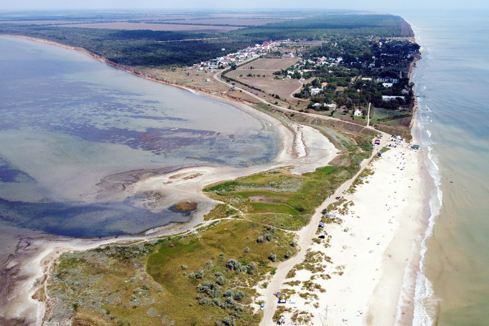
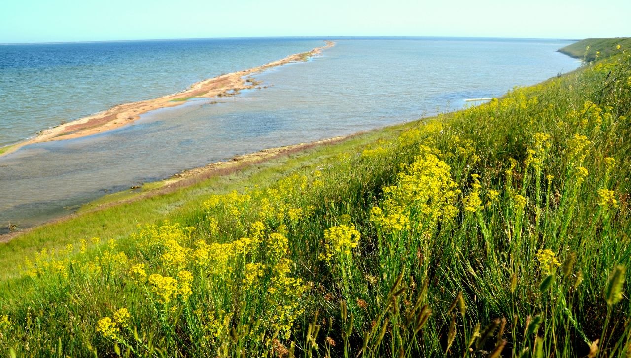
The lakes of the Tuzly group are shallow Black Sea estuaries of a semi-enclosed type in the lower reaches of small rivers. All of them are separated from the sea by a narrow sandy spit about 40 km long and 50 to 400 meters wide. The area is characterized by an unusual geological landscape. The mainland shores have a height variation of 2 to 18 meters and are steep.
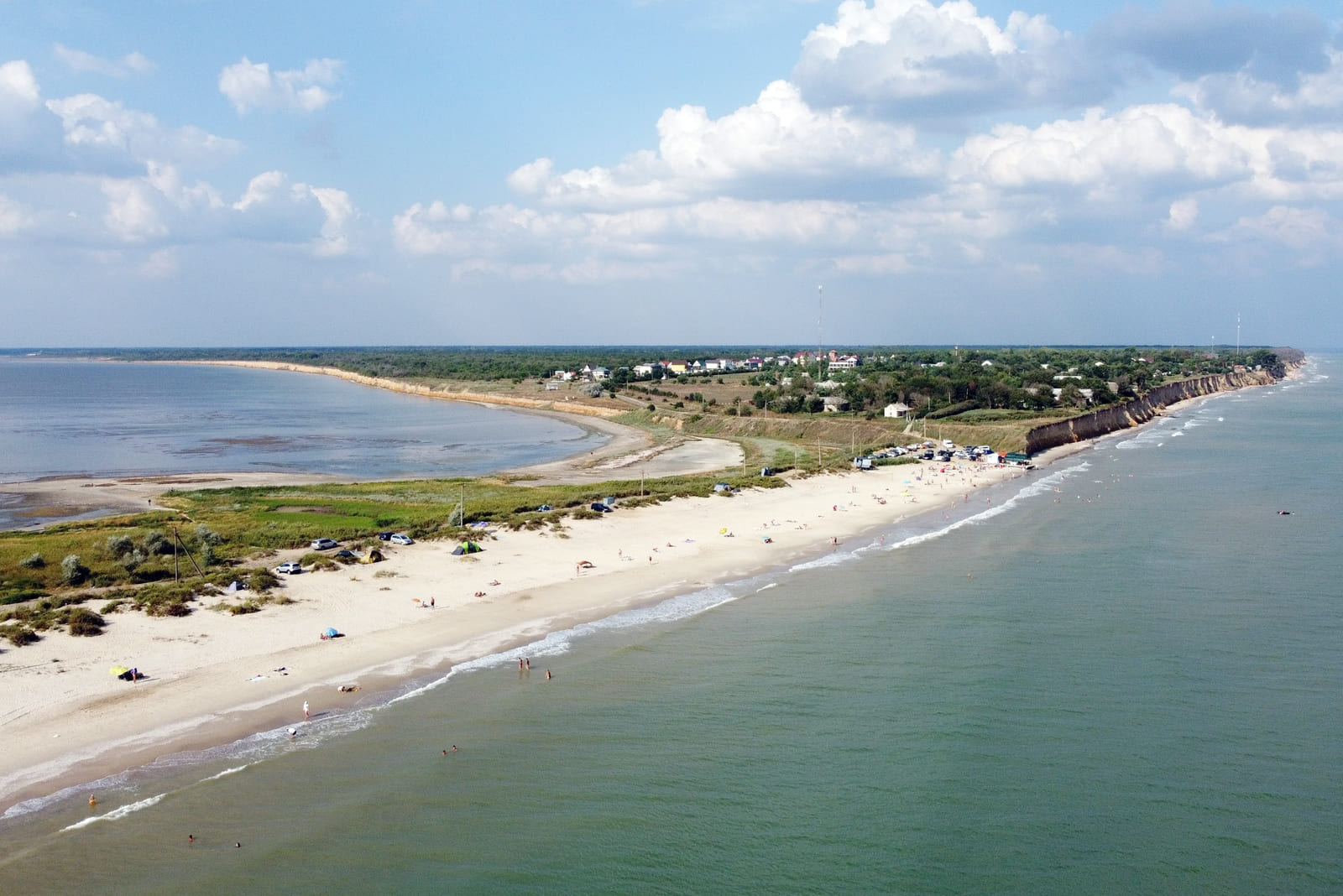
A sandy embankment between the estuaries and the sea. PHOTO: zatoka.travel
The Tuzla complex of the Black Sea estuaries is of great importance for maintaining biodiversity not only in the region but also on a global scale. In general, this area plays an important role in the natural functioning and interaction of the Black Sea coastal ecosystems.
The formation of the Tuzla estuaries began several millennia ago. Advancing and retreating Black Sea waters washed away sand and created natural barriers that separated the water area from the sea with a sand and shell embankment.
The estuaries of the Danube-Dniester interfluve have their own peculiarities. The shape of their shores is close to a circle or elongated in a horizontal direction. This is explained by the fact that the estuarine coasts are covered with forests and formed by soft rocks, unlike limestone deposits on the shores of other water bodies. Soft rocks are easily subject to abrasive processes and erosion.
The Tuzly water system includes three primary, largest estuaries: Shagany, Alibey, and Burnas. A number of smaller secondary reservoirs are adjacent to them: Maly Sasyk, Solone, Kurudiyol, Khadjider, Karachaus, Budury, Martaza, Magale, Dzhantshey, and Maloshagansky.
The Burnas estuary. PHOTO: upload.wikimedia.org
The lagoons, which were named after the village of Tuzly on the right bank of the Burnas estuary, were originally part of ancient trade routes where local tribes were engaged in fishing and salt harvesting. The word "Tuzly" has Turkish roots, which means "salt". In the Middle Ages, the region became part of Bessarabia, where estuaries served as a natural border and their salty waters were used for salt extraction, bringing economic development to the surrounding villages.
As early as 1787, German immigrants founded the summer cottage village of Bad Burnas on Cape Burnas between the estuary and the Black Sea, which existed under that name until 1947. After the victory over the German-Romanian invaders, the village was officially renamed Lebedivka. The unique combination of the sea, the estuary with its healing resources, steppe and forest landscapes in the late nineteenth century made this corner of southern Bessarabia a popular tourist destination, and it remains so to this day.
Representatives of the flora and fauna of the National Park
The territory of the Tuzly Estuaries National Nature Park is characterized by a variety of floodplain landscapes, as well as specific flora and fauna. More than 700 species of plants listed in the Red Data Books of the region, Ukraine and Europe have been recorded here. Among them are herbaceous saltwort, feather grasses on the steppe slopes, orchids in the forests, and the rare Ankara late-flower that bloomed in the winter of 2025.
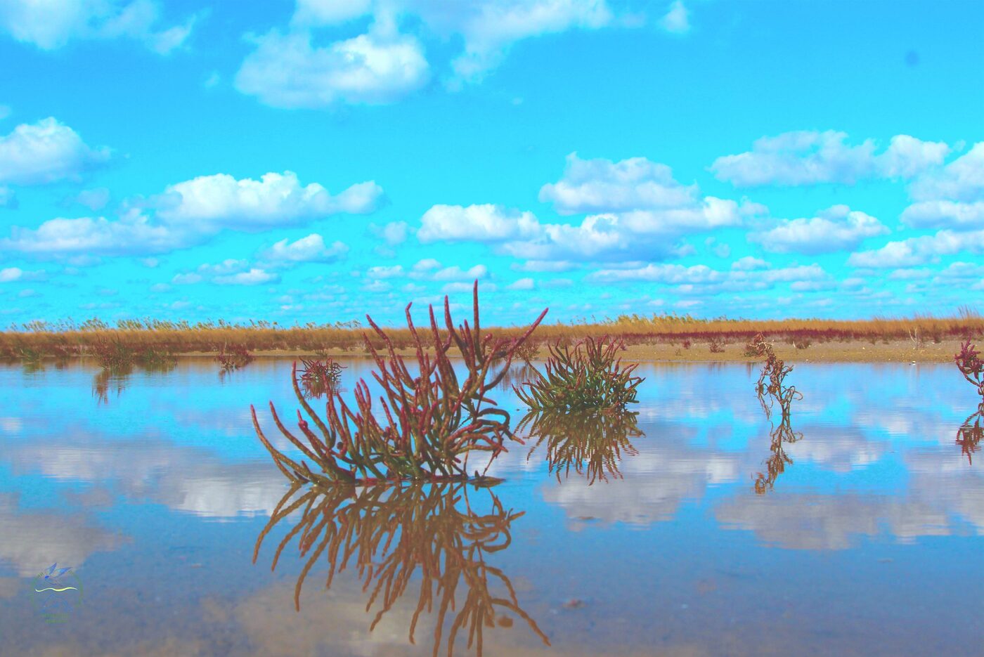
The flora of the Tuzly estuaries. PHOTO: wownature.in.ua
The park's fauna is best represented by birds. The park is of great importance as a nesting, wintering and stopping place during seasonal migrations of a large number of wetland birds. More than 250 species of birds have been recorded in this area, which is about 60 percent of the total number of species in Ukraine, 54 of which are listed in the Red Data Book of Ukraine or other protection lists. Here you can find the peganka, white-fronted goose, whooper swan, stilt, pied-billed grebe, swift and many other endangered species. Not only birds can be found in the park. About 60 species of fish live in the local reservoirs.
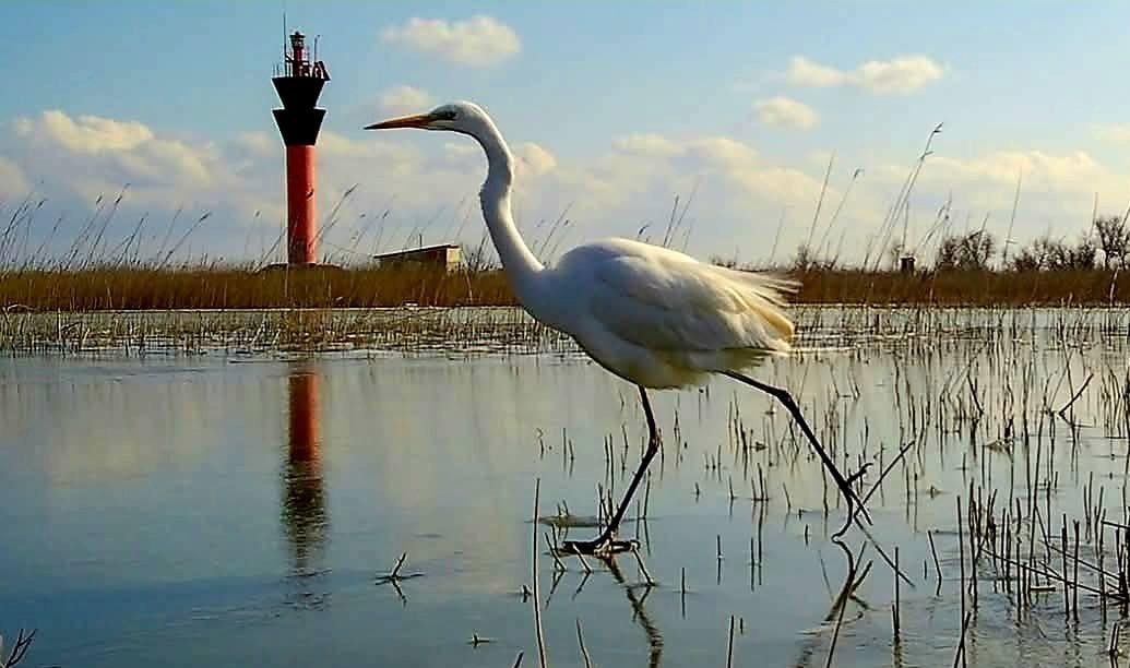
Fauna of the Tuzly Estuaries. PHOTO: images.unian.net
Balneological potential of the Tuzly Estuaries
Centuries of isolation of water bodies from the sea, high temperature and high salinity contributed to the formation of organic deposits at the bottom of the estuaries, which formed a layer of therapeutic mud - peloids. For centuries, people have been aware of the positive effects of various minerals, therapeutic muds and seaweed on the body and keeping it healthy.
There are many sources of therapeutic mud. The high concentration of trace elements, such as magnesium and potassium, ensures their effectiveness in treating skin, joints, and muscles. "Mud is formed under the influence of various microorganisms. As a result of the biochemical processes that take place with their participation, therapeutic mud is enriched with so-called biogenic components - compounds of carbon, nitrogen, sulfur, iron and others, many of which, for example, hydrogen sulfide, have high therapeutic activity," says Ivan Rusev, Deputy Director of the park, Doctor of Biological Sciences.
Sulfide-silt bottom sediments are formed in the Tuzly estuaries. They are highly mineralized compounds of different ionic composition with a predominance of iron sulfide. It is iron salts that cause the dark gray color of sulfide mud. They are also rich in iodine, bromine, and boron.
The waters of the Tuzly Estuaries hydroelectric system are interconnected. Due to hydrogeological connections, there is a constant exchange of water, so the chemical composition of the water is similar and characterized by high variability and instability. This is due to a number of factors: season, evaporation, and connection to the Black Sea. During the opening of the gulfs, the salinity level in the estuaries approaches the sea level, while during the closure it increases.
The Tuzly estuaries are predominantly bodies of salt water of the sodium chloride type, which often turns into brine, a supersaturated salt solution. The composition of the water differs only in the Dzhantshei estuary, where it is chloride-sulfate-sodium.
Bathing in the salty waters of the estuaries and mud applications are very useful. They improve blood circulation and metabolism, help relieve inflammation, heal the skin, and strengthen the immune system. However, self-medication and uncontrolled use of natural resources can be harmful instead of beneficial, so taking balneological procedures is recommended after undergoing an examination and as prescribed by a doctor.
Shahany Lighthouse or Tuzly Lighthouse
There are not only natural attractions in this region. For example, the Shagany lighthouse. It is a navigational structure in the form of a coastal tower on a sandy spit between the Shagany estuary and the Black Sea near the resort of Raseika. The lighthouse provides navigation for ships heading to the commercial port of Ust-Dunaisky in the Danube Delta.
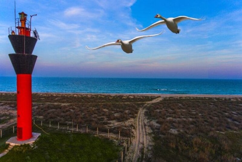
Shagany lighthouse. PHOTO: kvest.travel
The lighthouse tower has a total height of 16 meters, a fire height above sea level of 20 meters, and a fire visibility range of 14 nautical miles. The tower is located northeast of the beaches of the Raseika resort.
The lighthouse got its name from the Shagany estuary near which it was built. Its second name is apparently related to the Tuzly estuaries. Both names are found in literary sources, although the navigation structure is officially called the Shahany Lighthouse.
The Shahany Lighthouse was built in 1944, at that time in the Tatarbunary district near the village of Shahany. The purpose of the construction was to provide navigational support for ships to the port of Ust-Dunaysk in the town of Vilkovo.
Initially, the structure functioned as a navigational fire. In the sixties of the last century, the lighthouse underwent reconstruction, as did most structures of this kind. In the upper part of the reinforced concrete tower on a metal frame, 2 wooden cone-shaped visibility boards were installed. In 1983, a new light-optical device began to function on the lighthouse tower, which increased the range of fire visibility to 14 miles. Such capabilities helped the lighthouse to obtain the status of an automatic lighthouse.
The Tuzla Lighthouse is a popular tourist attraction, although climbing the tower itself is prohibited.
Interesting facts:
- In a purely geological sense, the Tuzly reservoirs are not estuaries, but a group of salt lakes created on the site of ancient flooded valleys.
- Every day, tens of thousands of different birds fly over the Tuzly Estuaries National Nature Park.
- Some birds fly low and are visible to the naked eye, such as pelicans, flamingos, swans, and cranes. Others can only be seen through binoculars or spyglasses. Most birds travel non-stop. Some stop in the park for 1-2 weeks.
- The best bird watching takes place on a narrow spit between the estuaries and the Black Sea.
- In the summer, during the hot season, the water in the Tuzly reservoirs acquires a pinkish tint. This phenomenon occurs as a result of algae fermentation in the estuaries, which causes pink foam to rise to the water surface. The result of algae fermentation in a few years is the appearance of therapeutic mud.
- From a bird's eye view, the Tuzly Estuaries National Nature Park looks like a crown.
The negative impact of hostilities on the park's environment
Like almost all protected nature reserves in the southern region of Ukraine, the Tuzly Estuaries National Park has suffered from the consequences of aggressive actions by the Russian invaders. Since the beginning of the full-scale invasion, the park has been suffering from enemy shelling, there are many rocket fragments on its territory, and there is still a danger of mining. Due to the hostilities, the park is currently closed to the public.
According to Ivan Rusev, the park's deputy director, many representatives of the park's fauna and the Black Sea coast have been killed. The occupants have blocked shipping in the Black Sea and mined part of its waters. They are constantly shooting from powerful surface and submarines. In addition, the Russian invaders use military sonar: this has a negative impact on animals, especially dolphins, which fall into the radiation zone. However, it is not possible to assess the full scale of the tragedy at this time, as environmentalists cannot explore the entire coastline due to the fighting.
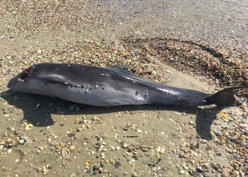
The consequences of Russian aggression. PHOTO: ecoaction.org.ua
How to get to the Tuzly Estuaries National Park
From the settlements of Odesa Oblast, you can get to the park as part of organized excursions or on your own using your own or rented transport.
From Odesa, you need to take the M15 highway (Odesa - Reni) to Tatarbunary. From Tatarbunary, the road leads to the villages located directly next to the estuaries:
- с. Kurortne (northern part);
- с. Lebedivka (near the sandy embankment);
- с. Prymorske (southern part).
Regular buses from Odesa depart to these settlements from the Privoz bus station or the Central Bus Station. Travel time: about 1.5-2 hours from Odesa (about 100-120 km). The most convenient access points to the park are Lebedivska Spit or the outskirts of Kurortne village.
Юлія Сичова