01 September 2026, 21:15
An interactive map of drone threats has been created for Kherson and the surrounding area
Ця стаття також доступна українською

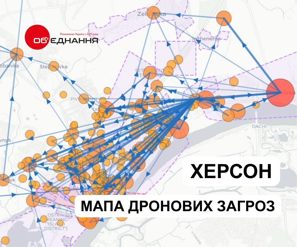
Photo: Screenshot from the drone threat map
An interactive map of drone threats has been created for Kherson and the Kherson region—an analytical tool that helps assess the security situation and plan operations in the frontline region.
This was reported by the Kherson Regional Charitable Foundation “Ob’ednannya,” which developed the map.
The map shows where, when, and with what intensity Russian troops are attacking civilian areas in Kherson and nearby settlements. The data comes from open-source primary sources and is updated weekly.
The tool allows users to analyze:
- the geography of threats—the larger and redder the dot, the more threats were recorded in a specific location during the selected period;
- attack trends—how their intensity has changed over the course of the year;
- types of threats—specifically drones, “Lightning” missiles, “Mavic” drones, and others;
- time of attacks—the distribution of threats by hour of the day;
- drone flight paths—based on reports of flight direction and launch location;
- statistics for individual locations—after clicking on a point, you can view trends, threat types, and directions;
- data for a specific period—selected dates are saved in the URL, allowing you to use a link to the corresponding snapshot in reports, presentations, and publications.
The map also marks mandatory evacuation zones in accordance with the current decision of the Regional Defense Council—from the coastal strip of Kherson to the villages on the right bank. Zones designated for the mandatory evacuation of children are highlighted in a separate color.
As of early September, the map contains over 23,700 reports of drone and aerial threats since the beginning of 2026. In January, an average of 34 threats were recorded per day; in May, 137; and in August, 218.
The highest number of reports in a single day was recorded on August 5—325.
The drone threat map can be viewed at this link.
The foundation clarified that the map does not replace the official warning system and is not a tool for rapid response—its purpose is to help identify trends and better assess the environment in which organizations operate.
The data source is the “Radar Kherson” Telegram channel.
In August, a video went viral showing a Russian FPV drone chasing a man at a market in Kherson and eventually attacking him.