06 October 2026, 11:08
A satellite captured the collapse of a span of the Chongar Bridge
Ця стаття також доступна українською

PHOTO: Dnipro Osint
The Chongar Road Bridge, which is one of the key land links between occupied Crimea and the Kherson region, has sustained significant damage. Satellite images show that one of its spans has collapsed.
This was reported by Dnipro Osint, citing satellite imagery.
According to the monitoring group, as of September 26, at least three large holes in the road surface were visible on the bridge and the nearby crossing. This significantly hampered traffic and caused a backup of logistics vehicles, including military ones.
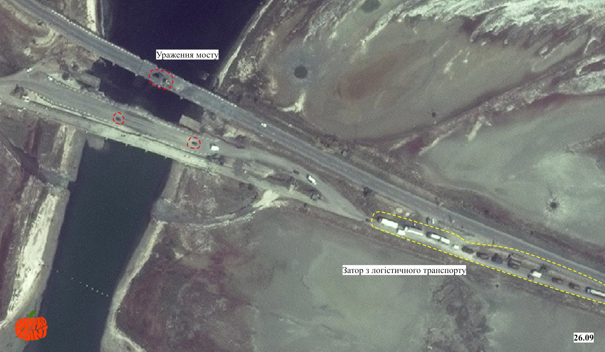
PHOTO: Dnipro Osint
A satellite image from September 30 already shows the collapse of one of the spans of the Chongar Road Bridge.
The Chongar Bridge is a vital transportation artery connecting Crimea with mainland Ukraine. According to Dnipro Osint, it has been repeatedly attacked by the Ukrainian Defense Forces.
The monitoring group notes that the destruction of the bridge is part of a systematic campaign to disrupt Russian logistics in the southern sector.
On the eve of the anniversary of the strike on the Crimean Bridge, the Russian Navy heightened its readiness. In particular, the Russian command allegedly ordered an increase in the frequency of patrols in the area and intensified preparations for potential threats from the sea.
Earlier, Dmytro Pletenchuk , a spokesperson for the Ukrainian Navy, stated that Russian warships have not left their Black Sea harbors for the fourth consecutive month.