26 July 2026, 06:59
The Amazing South: "Pryingulsky"—the newest landscape park in the Mykolaiv region
Ця стаття також доступна українською

"Pryingulsky" Regional Landscape Park. PHOTO: scontent-iev1-1.xx.fbcdn.net
The "Pryingulsky" Regional Landscape Park is a unique nature reserve in Ukraine covering an area of over 3,150 hectares. Its territory combines ancient geological formations, areas of virgin steppe, and valuable historical and architectural landmarks. This gem of the Mykolaiv region will be the focus of our next episode of the “Amazing South” series.
This natural complex is located in the picturesque geographical region of the northern Black Sea coast—the Pringul. This is the name given to the area in the Ingul River basin, located primarily within the Mykolaiv Oblast. This region is known for its wild nature, rocky shores, protected steppes, and rich history. For millennia, the Ingul River valley has served as a habitat and battlefield for dozens of nomadic peoples and settled civilizations.
Geological Foundation and Historical Records
The historical development of the Ingul region has been significantly influenced by its geographical location and geological structure. The territory lies within the Ukrainian Shield—an ancient Precambrian structure. In the Ingul Valley and the valleys of its tributaries, crystalline rocks occasionally emerge at the surface, forming rock outcrops, stony banks, and small rapids. The age of the rocks found within the “Pryingulsky” Regional Landscape Park is estimated to be approximately 1.8–2.1 billion years.
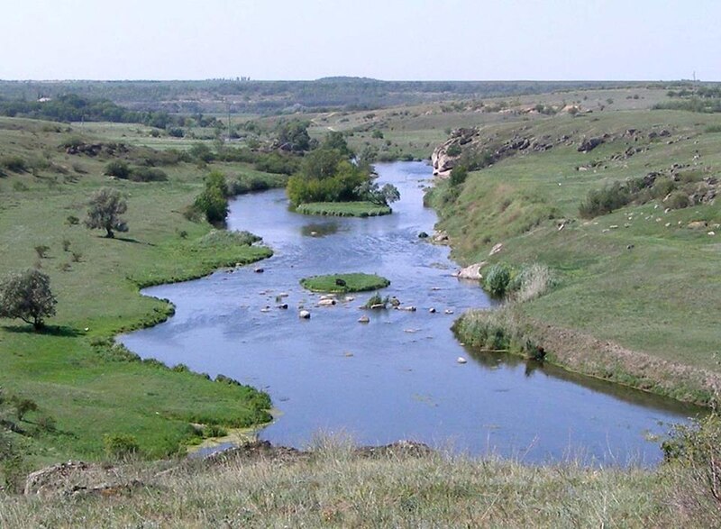
The Ingul River. PHOTO: pryingul.inf.ua
For ancient humans, the Ingul Valley was an ideal refuge: the cliffs provided protection from the winter winds of the Black Sea region, the river supplied drinking water and fish, and the steep granite cliffs served as the natural walls of a fortress.
The Wild Field of Nomads
Archaeological finds in the Ingul Valley attest to a constant succession of cultures. The Cimmerians ruled the Ingul region in the 1st millennium BCE. They were the first people on the territory of Ukraine whose name is documented in history. They were skilled horsemen and warriors. The Cimmerians’ raids reached as far as the Caucasus, Asia Minor, and Central Asia. They were the first in the region to work with iron and used rocky plateaus as sacred sites and observation points.
In the 7th–3rd centuries BCE, Iranian-speaking nomads—the Scythians—became the rulers of these lands. They formed a powerful confederation, Great Scythia, and left behind burial mounds on the steppe plateaus towering above the river (for example, Tovsta Mohyla or Chortomlyk) as a testament to their existence.
Beginning in the 3rd century BCE, Sarmatian tribes advanced into the steppes of the Northern Black Sea region and gradually strengthened their influence there, displacing part of the Scythian population. The Sarmatians were skilled horsemen; their army included units of heavily armed cavalry, whose primary weapons were long spears and swords. Some riders, and in some cases their horses, wore protective gear. The Sarmatian cavalry is considered one of the factors that influenced the further development of European heavy cavalry.
During the Middle Ages, the Pringulya region became an integral part of the Great Steppe, or the Wild Field. This was the name given in the 15th–18th centuries to the vast, sparsely populated steppe expanses between the Dniester, the Don, and the Sea of Azov. Due to constant raids by nomads, there were no permanent settlements here for a long time.
In the 9th–13th centuries, during the time of Kievan Rus’, the Great Ingul (as the river was referred to in the chronicles of that period) was an important branch of the trade route “from the Varangians to the Greeks.” The Pechenegs, and later the Polovtsians, fought for control of its crossings. Granite outcrops served as landmarks for caravans in the boundless steppe.
The Cossack Era
In the 16th–18th centuries, the Ingul region became a border zone between the Lower Zaporizhian Host (the Bug-Gardivska Palanka) and the territories of the Ottoman Empire (the Crimean Khanate). The Zaporozhian Cossacks valued the local landscape for its numerous ravines and ravine forests. Along the Ingul River, Cossack winter settlements—fortified farmsteads engaged in cattle raising and fishing—began to appear. The river rapids (now known as the “Porozhky” tract) were used by the Cossacks to set up secret crossings and ambushes.
Modern History
After the dissolution of the Zaporizhzhia Sich and the incorporation of these lands into the Russian Empire at the end of the 18th century, the region began to be actively settled by a sedentary population. The lands were granted to nobles and military officers. Economic and cultural life flourished on the territory of the modern park. In the early 20th century, the lands of the Pringulya region caught the interest of the renowned Tropin dynasty. The Tropin brothers built a modernized estate here, laid out a park, and introduced methods of steppe agriculture that were advanced for their time. The estate became the administrative and cultural center of the micro-region.
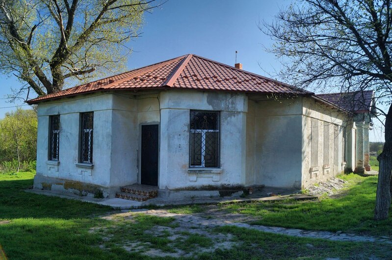
The Tropin Estate. PHOTO: R. Malenkov
In 1904, St. Michael’s Church was built on a high granite cliff near the confluence of the Ingul and Stovbova Rivers. It was erected by the Durilin brothers in memory of their mother, Pelageya, who passed away at a young age. This architectural marvel of red brick, featuring 12 domes and crosses inlaid with German mirrors, became the main spiritual beacon of the Inhul region. Today, it is an active women’s monastery, standing alone on the high bank of the Sofiivskyi Reservoir.
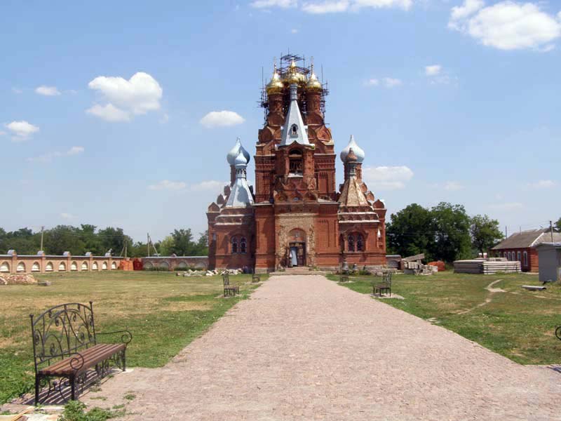
St. Michael’s Church. PHOTO: M. Romanenko
Sofiivskyi Reservoir
The 20th century brought radical changes to the region’s topography. In 1968, the Sofiivka Reservoir was constructed in the Ingul River valley; it is located northeast of the village of Sofiivka within the modern Bashtanka District of Mykolaiv Oblast. It is the second-largest reservoir in the region, stretching 18 km from south to north.
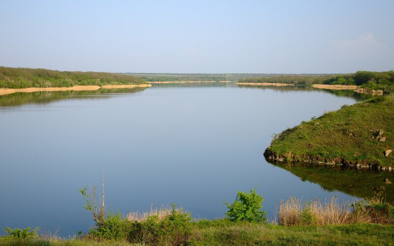
Sofiivka Reservoir. PHOTO: upload.wikimedia.org
The Sofiivka Reservoir altered the hydrological regime of the Inhul River. The creation of the reservoir marked an important stage in the development of the region’s water management. Artificial regulation of the flow has made it possible to ensure a stable water supply to settlements, store water for agriculture, and control seasonal fluctuations in the water level of the Ingul River.
During the construction of the Sofiivka Hydropower Complex, engineers implemented a unique design solution: they carved an artificial canyon into the granite rock to discharge floodwaters. The creation of the canyon permanently altered the original landscape and gave rise to new man-made and natural features, including the famous artificial waterfall, which is part of the hydroelectric complex’s spillway system. The water from the waterfall rushes down the granite slabs of the canyon in a powerful stream. Over time, the artificial reservoir has transformed into a fully-fledged natural ecosystem.
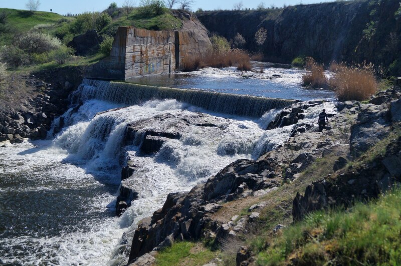
Artificial waterfall at the Sofiivka Reservoir. PHOTO: joyreactor.cc
Today, a variety of habitats have formed here: riparian reed thickets, shallow and deep-water areas, floodplain vegetation, and steppe slopes. This diversity supports a wide variety of fish, amphibians, reptiles, insects, and birds.
The reservoir plays an important role during seasonal bird migrations. For many bird species, it serves as a place to rest, feed, and nest.
The Park’s Establishment
The “Pryingulsky” Regional Landscape Park was established on December 17, 2002, by a resolution of the Mykolaiv Regional Council with the aim of protecting the Ingul River valley.
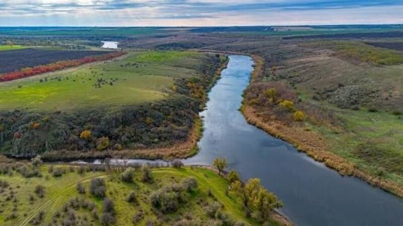
"Pryingulsky" Regional Landscape Park. PHOTO: Facebook page of "Pryingulsky" Regional Landscape Park
For centuries, human activity has depleted the steppe ecosystem. Finally, the value of this historical and natural complex was recognized, and the idea of creating a nature reserve emerged—an idea that had been discussed as early as 1989 by local activists and the “Pryingulya” Foundation.
Today, the “Pryingulsky” Park is a living open-air museum where ancient 2-billion-year-old granites, Cossack heritage, aristocratic architecture, and Orthodox shrines have merged into a single historical landscape.
Geological and Natural Landmarks of the Park
Within the “Pryingulsky” Park, the Ingul River cuts deeply into the ancient crystalline rocks of the Ukrainian Crystalline Shield, exposing granite layers dating back two billion years. Let’s take a look at some of them.
The “Devil’s Bridge” Granite Plateau
This rocky plateau is located at the confluence of the Ingul and Stovpova Rivers. The plateau offers a panoramic view of the canyon, the virgin steppe, and the Sofiivskyi Reservoir basin.
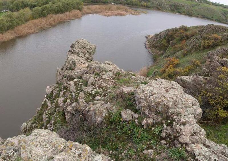
The “Devil’s Bridge” Granite Plateau. PHOTO: photos.wikimapia.org
There is a legend that explains the plateau’s strange name. It is connected to the story of two Turkish brothers who, in ancient times, set up a toll crossing here. Because of their dark skin and stern appearance, the locals nicknamed them “devils,” and this place—their “bridge.”
The “Pillar” Rock, or the Rock of the Petrified Heroes
This is a majestic vertical granite outcrop resembling a giant pillar or a frozen warrior.
The rock’s origin is also shrouded in legend. According to folklore, the heroes who defended these lands from foreign invaders were enchanted by a sorcerer and turned to stone. The outlines of their silhouettes can still be discerned in the curves of the rock under certain lighting conditions.
The “Owl” Rock
This is a massive granite formation that hangs directly over the water’s surface. The rock has an unusual shape: centuries of weathering have worn away the stone, transforming it into the likeness of a huge human face or a bird’s head. The site serves as a natural refuge for wild birds.
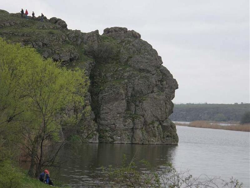
"Pugach" Rock. PHOTO: photos.wikimapia.org
The Coast of Stone Chimeras
This is a stretch of coastline with heavily weathered crystalline rocks. It is a unique mini-version of the famous “Valley of Ghosts” in Crimea. Under the influence of water, wind, and temperature fluctuations, the granite boulders have taken on bizarre, fantastical shapes resembling fairy-tale creatures, animal silhouettes, and human profiles.
"Porozhky" Nature Site
This is a picturesque natural area on the Sagaydak River, along whose banks lie large boulders. The water rushes noisily through the granite barriers, forming small rapids, shoals, and whirlpools. The area’s banks are covered with dense, moisture-loving vegetation, creating a contrast with the steppe.
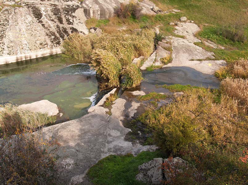
"Porozhky" Nature Reserve. PHOTO: B. Staroshchuk
Shchorsivsky Park and the Suspension Bridge
Next to the Tropin estate lies the historic Shchorsivsky Park, originally laid out as part of the manor. Centuries-old poplars, maples, and mulberry trees have been preserved here. A wooden suspension bridge on cables spans the Ingul River, connecting its banks. As you walk across, the bridge sways noticeably, adding a slight sense of adventure to the stroll.
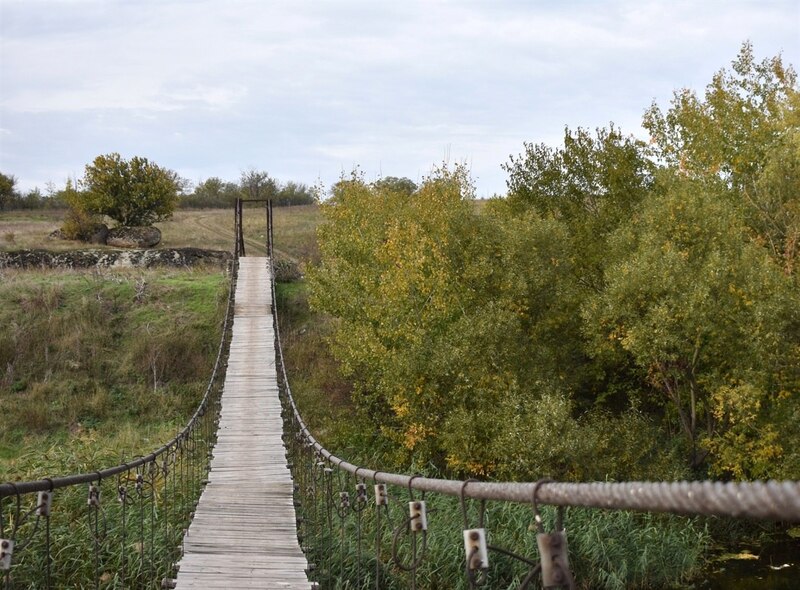
The suspension bridge in Shchorsivsky Park. PHOTO: omore.city
The Park’s Wildlife
The nature of the “Pryingulsky” Regional Landscape Park is striking for its biodiversity. About 600 plant species grow here, many of which are listed on Ukraine’s Red Lists (feather grass, sleep-grass, and the Bug tulip). In spring and summer, the valley slopes are covered with a carpet of flowers.
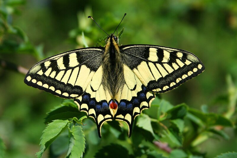
Swallowtail butterfly. PHOTO: upload.wikimedia.org
The fauna of the “Pryingulsky” Park is typical of Ukraine’s steppe zone and includes numerous species of invertebrates and vertebrates, mammals, birds, fish, and insects. Rare and endangered animal species protected by the state can be found here. These include the polixena, the common swallowtail, the giant scolius, the common xylocopa, the podalirius, the yellow-bellied toad, the steppe buzzard, the steppe polecat, the ermine, the river otter, and others.
Interesting Facts
- Local place names in the Inhul region still bear witness to Turkic influence. The name of the Ingul River derives from the Turkic words “Yenigel” (“New Lake”) or “Engül” (“quiet, smooth”), which highlights the nature of the river’s current upstream of the rapids.
- The main botanical value of the “Pryingulsky” Regional Landscape Park lies in the fragments of fescue-feather grass steppe that have remained untouched and have never been plowed.
- The large waterfall created at the Sofiivka Hydroelectric Complex is the largest man-made waterfall in the Mykolaiv region.
- In the middle of the Sofiivskyi Reservoir lies an island formed as a result of the flooding of part of the Ingul Valley during the reservoir’s construction. Its bedrock consists of outcrops of ancient, weathered crystalline rocks, and its shores are densely covered with trees and shrubs.
- Among the unusual natural features of the “Pryingulsky” Park is the so-called “living” rock—a massive boulder that overhangs massive crystalline granite slabs and rests upon them in a mysterious balance.
Юлія Сичова